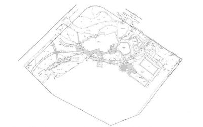
Land Surveyors need CAD Drafting to design and update maps which consists of the complete layout of the project. It is elementary for planning and execution of most of the construction projects. As per Government development principles, there are several constraints that need to be checked during surveying like water sensitive urban designing, habitat preservation, and several other restrictions to ensure sustainable development.
We are best at what we do, you will get high-quality work on time and with numerous rechecks. We offer high-quality services at a very reasonable price considering we use all the latest equipment and methods to provide you with detailed and thorough analysis. We specialize in providing survey drafting services for different type of sites ranging from small subdivisions to commercial sites of different sizes.
We provide detailed CAD drawings and civil site engineering drawings for; Subdivisions, Commercial Projects, and Residential Projects
Land Survey Drafting Includes
- ALTA & Topo Surveys
- Topographic Land Survey
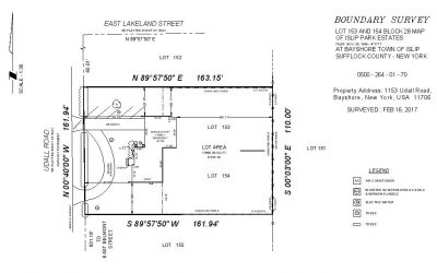
- Boundary Survey
- Route Survey
- Pipeline/Oil & Gas
- Right of Ways & Mortgage Surveys
- Tower Surveys and Tower AWS architecture
- Subdivision Mapping
More Survey Drafting Services from
ArcVertex


Why choose us?
- Price: We provide high quality work at very reasonable and affordable price.
- Quality: Our technicians have years of experience in this field and we use latest software.
- Time: We value your time, that’s why we provide quick turnaround at each level with 24 Hours delivery
- Deliverable: We will send you all the designs in time and will work with you until you are 100% satisfied.