These drawings are very important during the development phase of the project to get all the necessary details regarding the nature of the land for the project. Our team consists of all the experts with over 9 years of experience working with the clients. We provide these services for many clients from different countries including clients from Canada, USA, Germany, and Australia.
With the help of these surveys, any CAD professional can interpret all the information needed to formulate the plans for the construction of the project. Our experts will help the on-site technicians and workers to form complete databases which allow for better information sharing. It is a complete database management system which allows to easily access any data from any stage of the project.
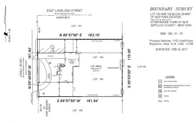
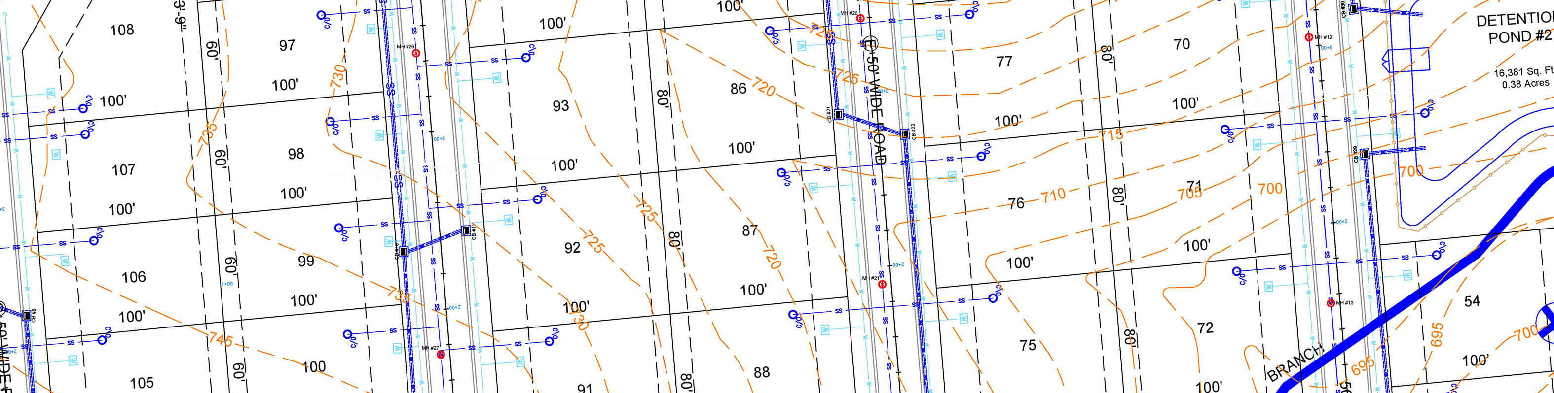
Topographic Drafting Includes
- 100% Accurate Linework/ Mapping
- Keep all Client's Standards
- Rectify Boundaries
- Tables & Blocks Creation
- Zoning & Labeling
- Easements & Utility Mapping
Other ArcVertex's Services
How It Works
Fast Delivery | High Quality
Upload Your File
Our Experts at Work
Revision If Required
Delivery Within 24Hrs*